
Satellite imagery reveals the devastating effect on natural resources caused by the recent massive volcanic eruption on Indonesia’s Ruang Island.
The pictures, accessed by Newsweek from geospatial data provider Sentinel Hub, illustrate destruction of the island’s forest cover between mid-April and early May. The images also underline the effectiveness of a mass evacuation, as no deaths were reported.
The “before” shots show a lush green island with the relatively-small volcano at its center. But everything changes after the eruption. The entire island turns ash gray, indicating no form life on the island would have escaped the aftermath.
Drag slider
compare photos
![]()


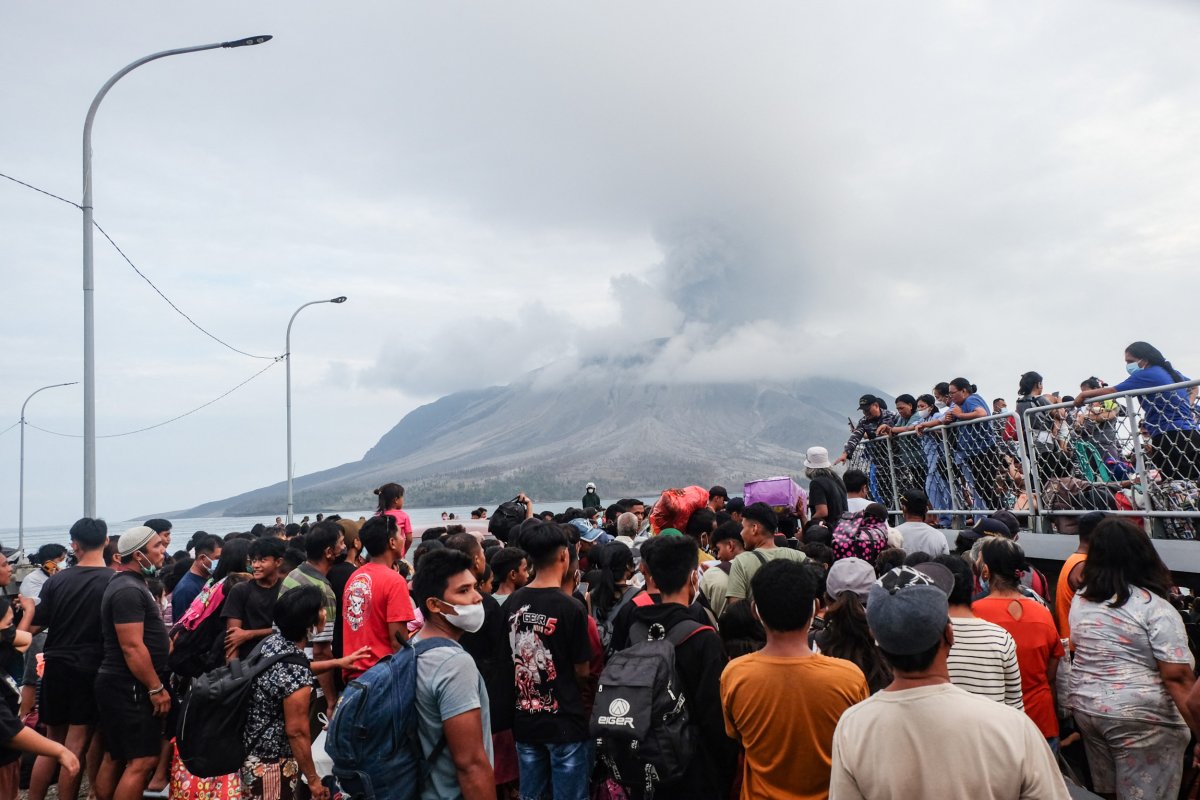
Ash and volcanic debris have damaged crops as well as hundreds of homes and buildings in the area, according to Indonesia‘s disaster agency. Flight cancellations and airport closures were reported due to the ash hazard stretching 3 miles up into the sky.
Thousands of people living on or near the island were relocated, to avoid potential threats to life, including lava flows, landslides, and tsunamis, if parts of the volcano collapsed into the sea, as well as the lethal ash clouds.
“When the Ruang Volcano erupted on April 30, 2024, the location was vacated considering the dangers that might threaten the safety of the community,” Bejo Prabowo, who heads Jakarta-based Infomitigation, told Newsweek.
“In fact, the evacuation of residents was carried out in the early phase of the eruption,” Prabowo added. His nonprofit organization focuses on disaster mitigation with the help of satellite remote sensing.
“The distribution of sulfur dioxide and volcanic ash also increases the vulnerability to acid rain in several areas in North Sulawesi and even East Kalimantan,” Probowo added.
Ruang experienced two incidents of volcanic eruptions, on April 16 and April 30, which led to the displacement of people living in the area.
In total, some 12,000 people living within 3.7 miles of the crater were evacuated, including residents of nearby Tagulandang island.
Mount Ruang is one of more than 120 active volcanoes in Indonesia. The archipelago sits along the seismically volatile Ring of Fire region around the Pacific Ocean, an area prone to frequent earthquakes and eruptions due to shifting tectonic plates.
Videos posted online in recent days show a massive column of ash billowing more than 16,000 feet into the air from the steep-sloped stratovolcano. These symmetrical volcanoes are created by thick lava that doesn’t flow easily, building up high gas pressure that can trigger explosive eruptions like Mount St. Helens in 1980.
Prabowo recently told Newsweek that the blast on April 30 may have been Mount Ruang’s biggest since 1871. He added that the eruption was larger than the one on April 16, which ended a period of relative calm over the past two weeks.
The 2,400-foot volcano in North Sulawesi province had exhibited increased activity last month, before the April 16 explosion.
“Renewed eruptions from a remote Indonesian volcano have triggered fresh evacuation orders and sparked flight cancellations and airport closures this week with smoke, lava, and volcanic gasses spewing out of the fiery mountain,” CNN reported on May 2.
Though the volcanic activity may have slowed down for now, the threat to the people in the area remains.
AFP via Getty
Uncommon Knowledge
Newsweek is committed to challenging conventional wisdom and finding connections in the search for common ground.
Newsweek is committed to challenging conventional wisdom and finding connections in the search for common ground.
Comments are closed.